
New Zealand's North and South Islands are Still Moving Closer Together Two Years after a Monstrous Earthquake

A massive magnitude-7.8 earthquake that slammed New Zealand in 2016 caused the country's main islands to move closer together and scientists say the two islands are still creeping closer together to this day. Scientists at the New Zealand research institute GNS Science analyzed the area between the North and South islands after the so-called Kaikoura earthquake and found the South Island's Cape Campbell had crept northeast and was now 14 inches closer to Wellington on the North Island, New Zealand news site Stuff reports. The 2016 Kaikoura earthquake saw at least 25 fault lines be torn apart, making it one of the most unique earthquakes ever observed.
The tremor's epicenter centered on Waiau, a small town on the northern side of South Island, and ruptured north toward Cook Strait, the body of water between the two islands. Over the next minute and change, parts of the coast along Marlborough, the most northwestern region on South Island, lifted more than 20 feet and dropped more than six feet in others. The quake covered nearly 110 miles in about 74 seconds. The movement is too gradual to be felt by residents of the islands and the majority of the movement following the quake has already been made. For now, the islands will continue to move closer together, but that will end over time. New Zealand experiences more than 15,000 earthquakes each year — though only 100-150 are strong enough to be felt — due to its location between the Indo-Australian and Pacific tectonic plates, according to GNS Science. Several magnitude-6 earthquakes are expected every year, one magnitude 7 can be expected every 10 years and a magnitude 8 can be expected every century in New Zealand.
Source: https://weather.com/news/news/2018-11-28-new-zealand-island-kaikoura-earthquake
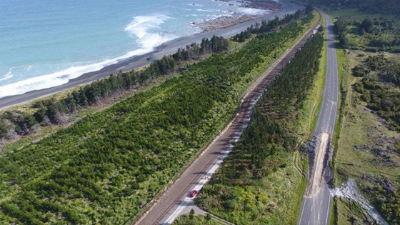
Image Source : https://weather.com/news/news/2018-11-28-new-zealand-island-kaikoura-earthquake